Liens geodata.earth
Liens geodata.earth
Nuage de tags
Mur d'images
Quotidien
Flux RSS
Connexion
Supprimer
Rendre public
Rendre privé
Rester connecté
Mur d'images - 11 images
Géodésie : un autre regard sur la Terre - Science En Questions
Latitude and longitude precision / Volodymyr Agafonkin / Observable
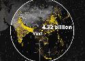
Stats, Maps n Pix: The Yuxi Circle
Éclairage Public - Gestion et visualisation du réseau avec QGIS et PostGIS - Geotribu
"Journalisme géospatial" : comment informer avec des images satellites - YouTube
Finding length and width of polygon using QGIS - Geographic Information Systems Stack Exchange
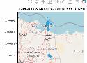
Cartographie numérique: « Personne n'habite ici » ou comment cartographier le vide ?
35 Differences Between ArcGIS Pro and QGIS 3 - GIS Geography
Movement data in GIS #35: stop detection & analysis with MovingPandas | Free and Open Source GIS Ramblings
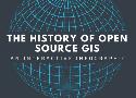
The History of Open Source GIS: An Interactive Infographic (Updated for 2021) - makepath
Peters vs Mercator 🔥 – Carnet (neo)cartographique
Replier
Replier tout
Déplier
Déplier tout
Êtes-vous sûr de vouloir supprimer ce lien ?
Êtes-vous sûr de vouloir supprimer ce tag ?
Le gestionnaire de marque-pages personnel, minimaliste, et sans base de données par la communauté Shaarli